
|
Copper River Record January 2017 By Robin Mayo Disclaimer: This is intended to be an introduction and summary, not the final word on a very complex issue! Since I started sharing the armchair hiking series, it seems there has been no shortage of topics for conversation at holiday gatherings, grocery checkout lines, and other hot spots for socialization. It has been great fun hearing about favorite hikes and gathering ideas for future columns. Inevitably, the conversation leads to some variation of one big question: How do I know where it is OK to hike? There isn’t one easy answer to this question, but a basic understanding of land ownership in the region helps. Obviously, hiking an established trail with a sign and kiosk at the trailhead guarantees that you have permission to go there. Even then, be aware—many trails are on fairly narrow easements crossing private land. But what about all the other cool places we are tempted to explore? Here is a simple summary of land ownership in the Copper Basin. We have vast amounts of public lands, owned by the state of Alaska or the federal government. State Lands are administered by Alaska Department of Natural Resources. Federal Lands in this area are looked after by either the Bureau of Land Management, or the National Park Service. With some exceptions, public lands are open for human powered recreation. Sometimes there is limited access or permits required, such as backcountry permits for National Parks. Wrangell-St. Elias has very few restrictions, permits are only required if you are with a large group, operating an off-road vehicle, or hunting. Staff at the BLM Glennallen Field Office are glad to answer questions or help you determine land status. Native Lands are private land owned by a regional corporation, a village, or an individual. In the Copper Basin, Ahtna Inc. owns a lot of land, Chitina Village and Chugach also have holdings in the southern regions. Native owned lands have no-trespassing policies, but some land managers provide ways you can get permission for recreational use. Ahtna, Inc. has a variety of passes available for purchase, from an individual day use for $15, to a $125 season pass. Chitina Native Corporation also has a permitting system for access to their lands. Following me so far? Here’s another layer of intrigue. 17(b) Easements are special corridors which were created to allow access across lands that were conveyed to Native Corporations by the Alaska Native Claims Settlement Act (ANCSA.) There are many of these routes scattered across the Copper Valley, and they can be used by anyone. You need to understand that the easements only allow you to cross, not to stop and camp, wander, pick berries, or hunt. Sometimes they are marked, or they can be found in the online tools detailed below. Private Land is scattered throughout the area, and of course should not be crossed without permission. There are also bits and pieces of land owned by the military, mental health land trust, and other entities, but in my experience they are not usually an issue. The Trans-Alaska Pipeline occupies a right-of-way, which is an easement across land owned by another entity. Alyeska does not mind hikers crossing the right of way , or travelling along for a short way to access recreational sites. But you still need to have permission from the land owner. If in doubt, you can contact the Glennallen Response Base to help figure it out. For large groups, long distances, or motorized travel they will usually give permission with a few days notice. Right of Way Use Guidelines (RUGs!) are available at Pump Stations and the Glennallen Response Base to help you understand the rules. Such entertaining reading—“A RUG is necessary for linear use of the ROW…” There are several online mapping tools available to help you research land status, and make sure your hike doesn’t become a trespass. These are very comprehensive databases that are made available to the public, but they aren’t what I would call user friendly for the average Jill or Joe. Depending on how you are with technology, it can be a ton of fun, or a hair-tearing frustration that has you swearing you’d rather live in a cave. Try enlisting the help of someone under the age of 30 with good intuitive techno skills, and make sure your computer and internet connection are smokin’. Alaska Department of Natural Resources Mapper (dnr.alaska.gov/Mapper) is a very thorough statewide database, but also pretty technical. Give yourself some time to figure it out and you will be rewarded with a wealth of information. The US Bureau of Land Management’s Spatial Data Management System (sdms.ak.blm.gov) is another very comprehensive, therefore potentially mind boggling database. At the time of this writing it does not seem to be active, perhaps because BLM is in the midst of a website update. I find it easier to navigate than Mapper, but that may be because I’ve worked past the frustration stage. Ahtna Inc. has a useful and easy to understand interactive map of Ahtna lands on their website (ahtna-inc.com/lands) and are happy to help anyone who comes in to identify Ahtna lands. And the Chitina Native Corporation has simple maps available (www.chitinanative.com)to help you figure out how to dipnet without trespassing. These tools will show you the general land status, but they do not list individual owners of private land, to determine this, you need to go to the State Recorders office in Anchorage, Palmer, or Fairbanks, or do an online search at (http://dnr.alaska.gov/ssd/recoff/default.cfm) Google Maps and ACME Mapper are two online mapping resources which don’t show land status, but can be a huge help in your research. BLM and the National Park Service both have paper maps available that can help with land status, but beware of old maps, because things change quickly. Confused yet? There is no easy solution, but I encourage you to learn about and be aware of land ownership issues whenever you are out adventuring. Yes, it can be a hassle, but in the long run respecting the land and the landowners is the best way for all of us to continue to access the places we love to explore. 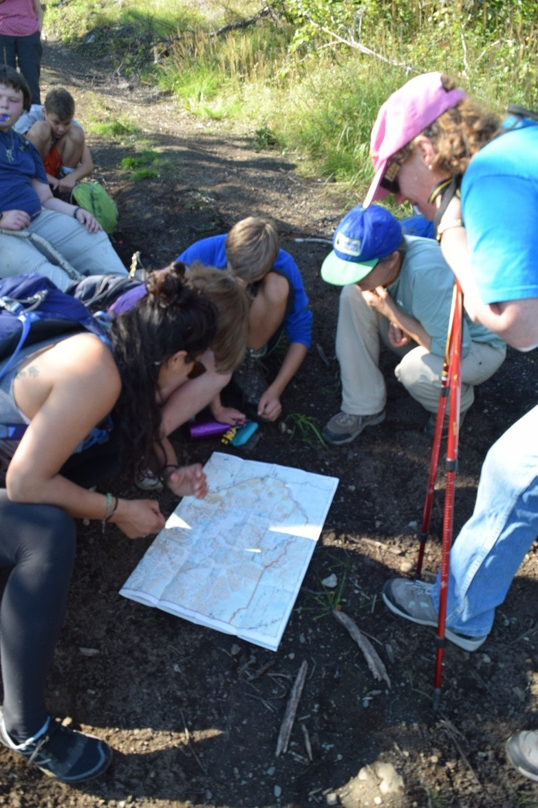 WISE staff, interns, youth, and adult hikers pore over a map
Jamie Dawson Photo
0 Comments
Leave a Reply. |

Who We AreWISEfriends are several writers connected with Wrangell Institute for Science and Environment, a nonprofit organization located in Alaska's Copper River Valley. Most of these articles originally appeared in our local newspaper, the Copper River Record. Archives
August 2021
Categories
All
|
 RSS Feed

|
WISE is a
501(c)3 nonprofit organization |
Contact Us |