
|
Copper River Record December 2016 By Robin Mayo It’s a picture perfect day as we motor across Prince William Sound on the MV Aurora. The sun is sparkling on pristine water, gulls wheel overhead, and in the distance fishing boats cluster. Some are already pulling their nets, and through our binoculars we see the wriggling masses of glistening salmon rise up then spill onto the decks. On the bow of the ferry, travelers are enjoying the warm sunshine and passing scenery, sharing sightings of whales, otters, and sea lions. They lean over the rails eagerly, craning for a glimpse of Dahl’s porpoises cavorting at the waterline. But in the ship’s lobby, the mood is more somber. A small group of high school students is gathered around a map of Prince William Sound, reliving the night over 25 years ago when the Exxon Valdez ran aground on Bligh Reef. We are transported to a cold night in March when a combination of events sent the tanker out of the shipping lanes, bleeding crude oil into the water. There is no easy answer to the question of “Why?” It is easy to blame the captain of the ship, but hearing the entire story, we learn that he was just one factor in a whole system that failed that night. Once the stage is set, the students are given first-person narratives from Exxon Valdez oil spill responders from the book “The Spill” by Sharon Bushell and Stan Jones. They are asked to put themselves in the shoes of the men and women who were there, then create a piece of artwork or writing to symbolize the experience. Individually or in small groups, they find quiet places on the busy ship to absorb the poignant stories. With the beautiful scenery as a backdrop, they read the pieces quietly to one another. Several hours later, we gather again by the map, with pastel drawings and poems in hand. One by one, the students introduce the narrators, summarize their stories, and share projects. Using their particular talents with words and pictures, the students expressed sadness at the lives and beauty lost, outrage at the injustices, pain at the futile waste. The crew was asleep. Content to place their fate, and the fate of their cargo In the hands of another. Their minds were at rest As they dreamt of the meaningless things That would never again occupy their thoughts. Little did they know that the meandering of their minds Would be rent apart by the sound of unforgiving, crushing rock Wreaking havoc on the hull. Little did they know this sound would forever haunt them, That their dreams would be filled with the sound That resulted in the release of liquid death. The sound that condemned thousands of souls to heartbreak and misery. The sound that destroyed an entire ecosystem. And yet they slept on. Oblivious to this wretched fate. Dreaming as Mother Nature held her breath. Nicole Friendshuh 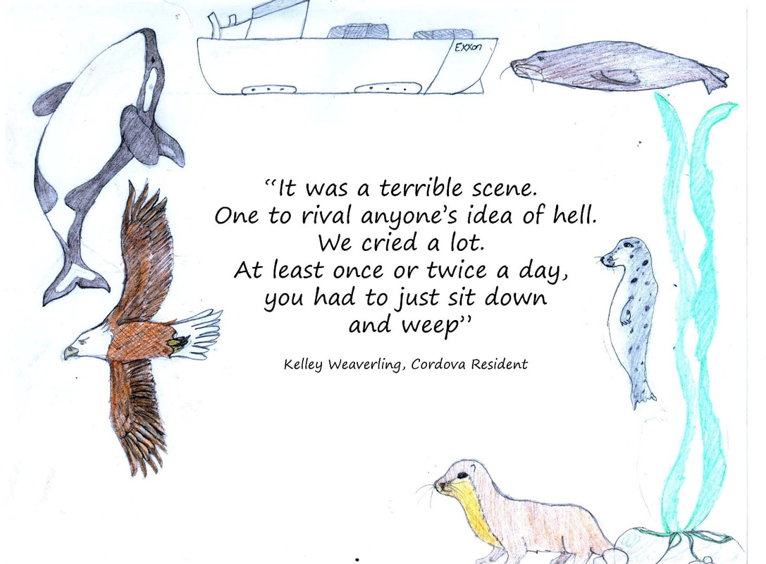 Artwork by Alexis Hutchinson
0 Comments
Copper River Record December 2016 By Robin Mayo Right behind Kenny Lake School is another hidden gem, a beautiful little trail complete with interpretive signs with student poetry, stories, and artwork. There is no signage on the highway, but everyone is welcome to explore this trail which winds through textbook Boreal Forest then connects with the trail along the brink of the Tonsina River bluff. Kenny Lake School is located at Mile 5 of the New Edgerton Highway. Park in the school parking lot, then follow the fire lane around the playground to the large field behind the school. At the SouthWest corner of the field, there is a small kiosk with trail information and a sign-in sheet. The trail is rustic, with some gentle ups and downs, and rough patches. Although it is less than a half mile to the bluff, you will want to give yourself plenty of time to enjoy the signs. It is especially fun if you know any of the kids who worked on the project as elementary students, and are now doing impressive grown up things like graduating from college and holding down real jobs. Where the school trail meets the bluff trail, there are comfy benches where you can sit and enjoy the sage-scented air and great views. Take a good look at the dirt of the trail for fresh tracks, bear and moose sign are common. If you head West on the bluff trail you will come to an outdoor classroom on a scenic point. Continue west and veer right to circle around back to school via the gravel pit, or veer left for a nice gradual descent down to the river. My favorite destination in this area is about a half mile East on the bluff trail, where there is another interpretive sign and a great place to view a dramatically eroded cutbank with interesting layers of volcanic deposit from long-ago eruptions. Please take care, the banks are constantly changing, and in many places are undercut. What looks like solid ground may be a matt of roots and topsoil hanging in the air. When we take youth groups to this area, the rule of thumb is don’t go near the edge unless you can see the solid slope below it. You can also connect to the trails on Wellwood Nature Preserve, which we will explore in a future armchair hike. In any season, this network of trails provides lots of options for hiking, skiing, or snowshoeing. The Tonsina River Bluff always has surprises in store, including the first Pasque flowers of the season, abundant wild roses, and even juniper berries. In summer there is almost always a breeze to chase away the mosquitoes, and on a wild wintry day it can be very exhilarating. 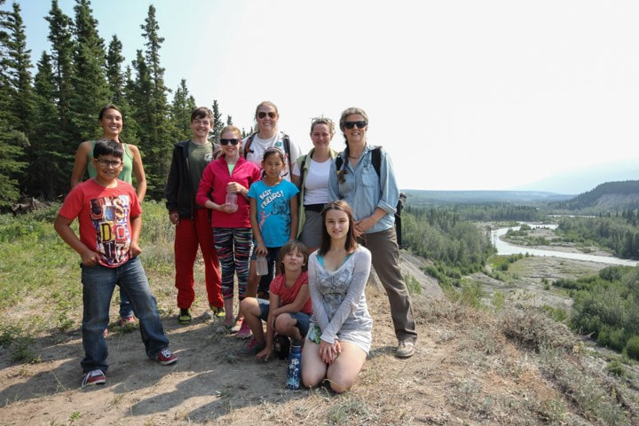 A group of WISE hikers at the lahar overlook with the Tonsina River in the background. Janelle Eklund Photo
Copper River Record December 2016 By Robin Mayo Okay armchair hikers, we’ve been getting out every week and should be getting in shape by now, so how about something a little more ambitious? The old Caterpillar road to Tiger Mine, also known as Fivemile Trail, is a challenging hike with great potential as a day trip, or a multi-day backcountry trek. The trail takes off south from the Edgerton Highway at mile 27.8, just west of the Chitina Airport. There is a small gravel pullout for parking. One resource I looked at for this hike called it “strenuous but straightforward,” and that sums it up perfectly. The first four miles or so are a steep, fairly steady uphill through thick forest. The trail has been drive-able in the past, although encroaching trees make this harder every year. But the good solid surface makes hiking a pleasure. At this point you are crossing Native Land, but the road is on a 50 foot wide easement. The high country is state land. Popping out above treeline makes the hard work worthwhile. The views of the Copper River and Wrangell Mountains are spectacular, wildflowers and berries are abundant, and Fivemile Creek is nearby. This area is part of the Tonsina Controlled Use area, where hunting with motorized vehicles or pack animals is forbidden from July 26 through September 30. This makes it an enjoyable refuge for quiet hikes during hunting season, when your other favorite spots may be overrun with ATVs. In early August I once crossed paths with a couple of intrepid sheep hunters hauling everything they needed on their bicycles. They were an impressive sight as they slowly pedaled their heavy mechanical steeds uphill. I hope they were rewarded with an easier but infinitely more exciting trip back down, tearing down the rutted trail laden with fresh meat. Once you are up in the high country, there are many options. I’ve heard it is possible to connect over to the Liberty Creek Trail and make it a loop, but have never attempted it, so do some research before committing to the trek. There are small peaks to climb, lakes and waterfalls, great views, and good campsites all along the trail. About 8 miles in, you can visit the site of the Tiger Mine, which was actively looking for gold and other minerals from 1987 until 1994. Wildlife sightings are frequent in the wide open spaces above timberline. The total elevation gain on the trail is about 3,500 feet, with many ups and downs. Anyone have a favorite hike they would like to suggest? I’m always open for ideas, although there are still an amazing number of adventures on my list to take us through the winter. No blisters, no bears, no hypothermia—armchair hiking does have advantages! But I do miss stopping to snack on blueberries and soaking in the sunshine. Good thing summer 2017 is just around the corner! 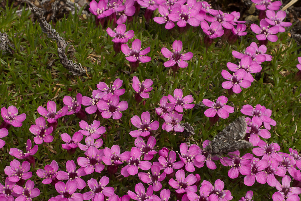 Moss Campion in the high country near Tiger Mine Trail
Photo by Janelle Eklund |

Who We AreWISEfriends are several writers connected with Wrangell Institute for Science and Environment, a nonprofit organization located in Alaska's Copper River Valley. Most of these articles originally appeared in our local newspaper, the Copper River Record. Archives
August 2021
Categories
All
|
 RSS Feed

|
WISE is a
501(c)3 nonprofit organization |
Contact Us |