|
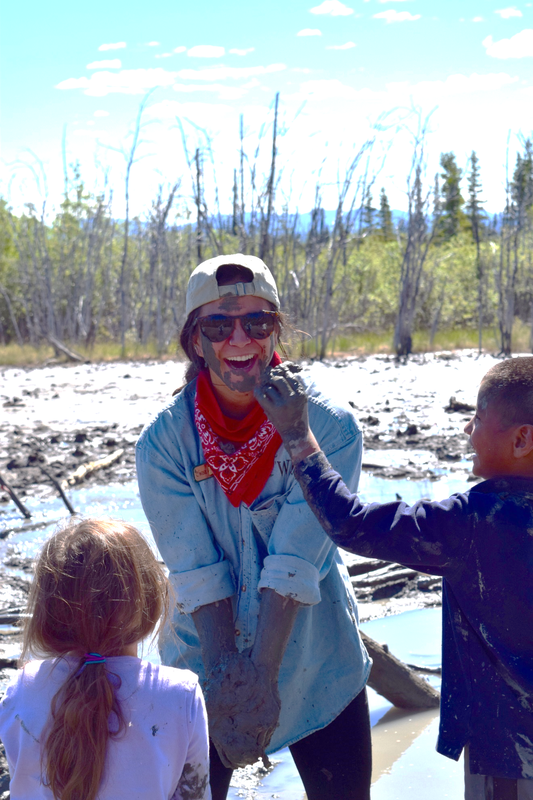
Copper River Record October 2016 By Robin Mayo One of the most fun and unique hikes in the Copper Valley can be found in a very unlikely place. Fourteen miles East of Glennallen on the Glenn Highway, down a gravel road to the idyllic Tolsona Wilderness Campground, and a mile on foot through a black spruce forest is a surreal landscape, the Tolsona Mud Volcanoes. If you are expecting a classic cone and dramatic fiery eruptions you’ll be disappointed, but if you are looking for an educational and adventurous outing with kids or visitors this is a sure winner. Mud Volcanoes are formed when gasses bubble up through layers of the earth, picking up water and mud as they rise. The Tolsona group consists of 3 cones, two of which are connected to the campground trail. The cones are large rounded hills, with vegetation on the lower slopes, and the active vents located at the top. The vents look like mud puddles, but are actually very deep, and bubble constantly with methane gases and fine, slimy clay. There are only a couple of hundred mud volcanoes in the entire world. The trailhead is located at Tolsona Wilderness Campground, and the proprietors ask visitors to check in and pay a very reasonable fee for parking. They can direct you to the beginning of the trail, which is marked with old CD’s tacked to the trees. It is about a mile meandering through the muskeg before you start to climb up the slight incline, noticing the changes in the vegetation as you get closer to the active cones. The trail is marshy in many places, but you’ll definitely be wearing rubber boots, so try to go straight through instead of making new trails around the wet spots. The vents offer plenty of fun, whether probing for the bottom, playing in the mud, or admiring the tracks of the many animals that frequent the place. Please be careful, especially with children, as the vents are deep, and the mud around the edges treacherously sticky. There are long poles nearby which could be used for rescue in an emergency. A favorite occupation is trying to capture the bubbling gases, then igniting them. We’ve tried it many times, and the most successful contraption has been a gallon ziplock bag taped to a forked stick. We left it there for about a half hour, then carefully sealed the bag, and pushed the gas out through a small hole. Having failed so many times, we were unprepared for success, and nearly lost our eyebrows when the concentrated gases burned with a dramatic whoosh. It’s nearly impossible to visit the mud volcanoes without getting at least a little muddy, and many explorers end up coated from head to foot. On WISE hikes, no one is allowed back into the van until they have rinsed off in Tolsona Creek, which runs conveniently right next to the parking area. You may want to bring plastic bags to cover your vehicle seats and protect them from the inevitable water and slime. If an outing can be measured by how tired and dirty we are at the end, any trip to the Tolsona Mud Volcanoes is a sure success. Tolsona Wilderness Campground can be reached at 822-3900 WISE summer intern Kiana Jenkins gets a facial at Tolsona Mud Volcano. Jamie Dawson Photo
0 Comments
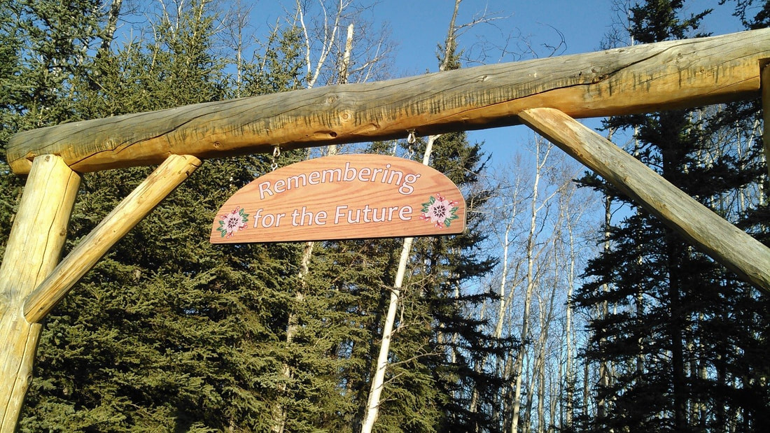
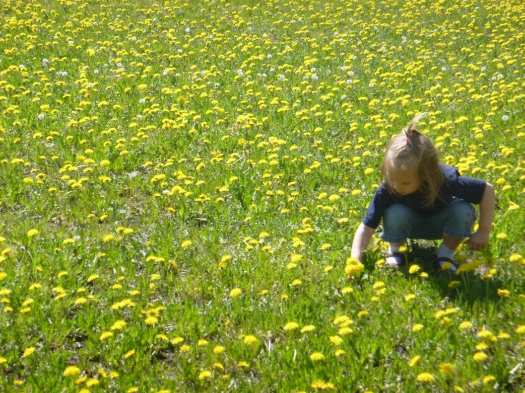
Copper River Record October 2016 By Robin Mayo It always feels sad to drive past the boarded-up Copper Center School, remembering trade fares and many good times when the school was the center of the community. One way to keep the place alive is to keep using the sweet little trail behind the playing field. It is short on drama but full of charm, and an easy destination for young families, or those who want a gentle walk. The bugs can be fierce in early summer, so come prepared, or wait until August to sample this pretty hidden gem. Take the Old Richardson Highway, then turn east on Silver Springs Road, which is about a mile from the north end of the Old Rich. At the bottom of the hill is Copper Center School, where you can park in the lot. It is heartening to see that the playground and grounds are clean and in good condition, I suspect local families have worked hard to keep the site inviting. At the edge of the parking lot is a small sign with history and a sketch map of the trail, so you know when to take a turn off of Ancestors Ave and onto Windchime Way. Walk through the playground to the playing field beyond, then along the north end of the field to the log arch and trailhead at the Northeast corner. The trail consists of two easy joined loops, so you can choose the length that suits you. The forest is mostly Quaking Aspen, with some White Spruce and Balsam Poplar. As the Aspen mature some of them are falling down, and one can see signs of succession in action, where the spruce are pushing their way up through the Aspen and shading them out. Along the way are delightful birdhouses and windchimes built by the students, and an outdoor classroom with benches and firepit. You can explore it all in an hour, with time to frolic in the dandelion-filled field. We held Youth Environmental Summit there in 2014, and the youth made us laugh by dusting their skin with the abundant pollen. This nice level trail also makes a nice ski or snowshoe outing. I must confess that I have not walked it recently, so there may be trees down across the trail. This trail and school hold so many memories for the community, it is a delight to wander down the paths. The motto above the log arch was perfectly chosen for this walk down memory lane. The dandelion strewn field at the beginning of the trail is a treat for all.
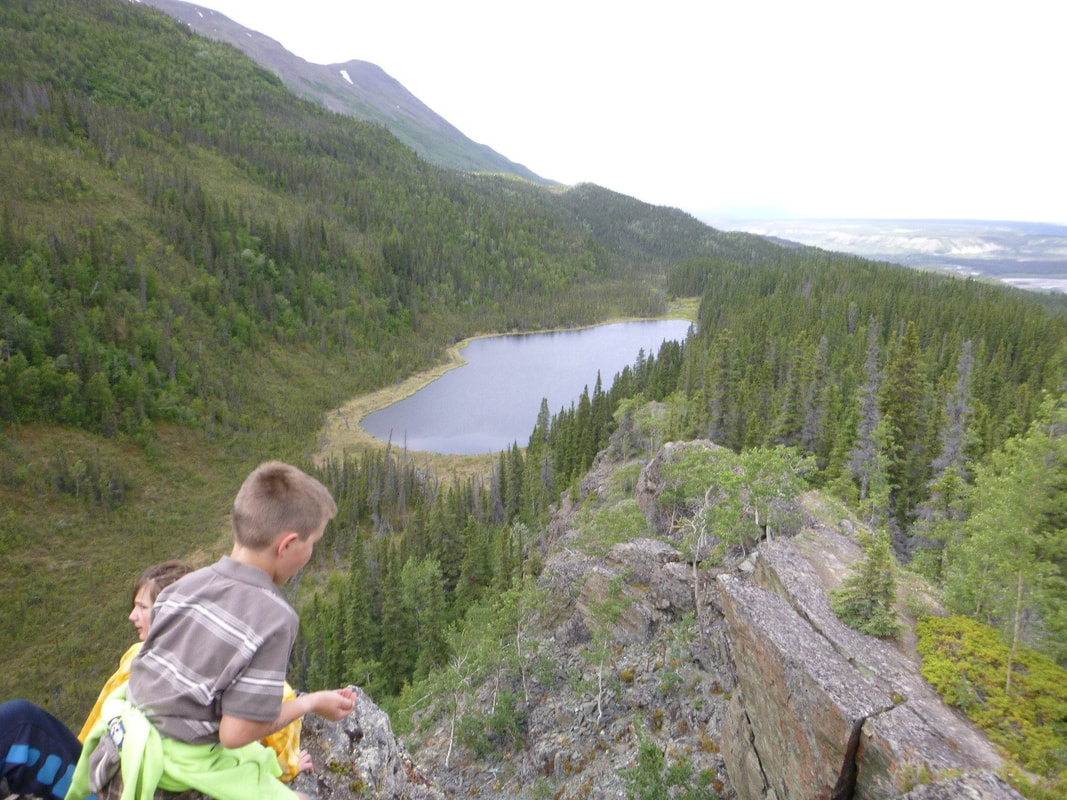
Copper River Record October 2016 By Robin Mayo Mile 24.8 Edgerton Highway. 2 miles round trip, 350 feet elevation gain. This winter, we invite you to learn about the many hiking opportunities in the Copper Basin. Armchair hikers can explore from one end of the valley to the other without leaving their cozy fireside seat! Each week we will feature a different hike in the hopes of inspiring many adventures when hiking weather returns. We’ll also delve into hiking etiquette, land management quandaries, and ramble on about gear, weather, and food. If you have a favorite hike you’d like to share, please contact me: 822-3575, [email protected]. The Liberty Falls Trail is one of the most perfect short hikes in the valley, with a well-developed trail, incredible views, and even several opportunities to jump in the water and cool off. It is easy to miss, though, as the trailhead is not at the Liberty Falls Campground, but about 100 yards west at mile 24.8 of the Edgerton Highway. The trailhead has a BLM-maintained kiosk with map and sign-in. The hike is about 2 miles total, out and back, and includes some steep sections, especially at the beginning. It climbs up the ridge through a dense spruce forest before breaking out at the top of the ravine overlooking Liberty Creek. To the North there are awesome views of the Copper River and the Wrangell Mountains beyond. The contrast between the sheltered forest and lichen-covered rocky ridge make the climb worthwhile. Plant lovers can enjoy a wide variety of ecosystems in a short hike. Parasitic Broomrape, which looks like an elongated spruce cone, can be found under the Alders near the trailhead. On the ridge, tiny alpine flowers thrive in shallow scraps of soil among the rocks. The trail then continues along the ridge, with occasional short ups and downs. The official end is a gorgeous rock outcropping, the perfect setting for a picnic lunch. On a hot day, you may be tempted to continue another quarter mile down to the small lake for a refreshing dip. Like many of our local trails, this is an out-and-back trail, and we wish it was longer. I’ve heard rumors of using Liberty Falls Trail as a jumping off spot to get up into the high country to the south, but have never tried it myself. It looks like there would be considerable bushwhacking involved. A better bet for accessing the Chugach in that area is the Tiger Mine Trail/Road, which we’ll cover later. Just beyond the “official” end of the Liberty Falls trail, this little lake beckons on a hot day. WISE photo
|
Who We AreWISEfriends are several writers connected with Wrangell Institute for Science and Environment, a nonprofit organization located in Alaska's Copper River Valley. Most of these articles originally appeared in our local newspaper, the Copper River Record. Archives
August 2021
Categories
All
|
|
WISE is a
501(c)3 nonprofit organization |
Contact Us |


 RSS Feed
